
 WSIL-TV
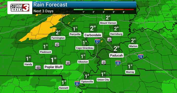
An active weather pattern is setting up over Southern Illinois, bringing the potential for several rounds of thunderstorms and heavy rain through early next week. We're monitoring the chance for strong to severe storms, especially Friday afternoon, with damaging winds being the primary threat.
Scattered showers and storms are possible today and tonight, especially after 10 PM. The main event kicks off Thursday and Friday, with a 60-80% chance of thunderstorms. Locally heavy rainfall is expected, with 1-2 inches possible, leading to a few localized flooding issues. While the severe risk appears highest on Friday, we will be closely watching for any shift in atmospheric conditions that could increase the severe threat.
The weekend will offer some relief, with a mix of clouds and sun and a

 WEVV 44News
 WACH Fox
 KRDO NewsChannel 13
 MSNBC Video
 MedPage Today
 Gossip Cop
 Political Wire
 FOX 10 Phoenix Health