
 News 19 WLTX
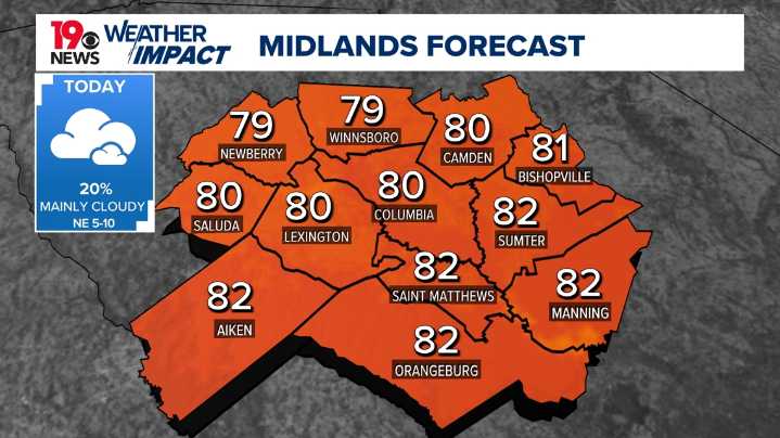
COLUMBIA, S.C. — The Midlands and much of the Southeast remain under the influence of cool temperatures and mostly cloudy skies as wedge conditions persist through the short term.
A gradual warming trend is expected to take hold early next week as upper-level ridging begins to weaken. Meanwhile, deeper moisture is forecast to return to the region by Sunday, bringing an uptick in shower and thunderstorm chances heading into next week.
In the near term, today’s weather will remain quiet and stable under continued wedge conditions. Water vapor imagery shows a trough axis approaching the Carolinas, with drier air aloft helping to suppress rain chances.
At the surface, strong high pressure remains anchored across the region, supporting a northeasterly flow that maintains low-level moisture.

 FOX Carolina
 The Post and Courier
 WIS News 10 South Carolina
 CBN Christian World News
 WJLA
WJLA The Kansas City Star Crime
 AlterNet