
 ClickOrlando
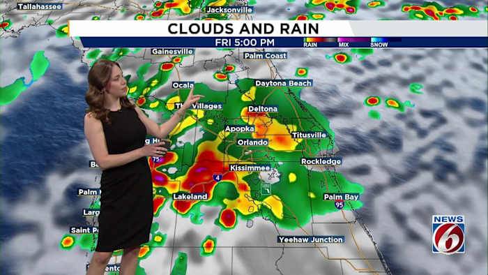
ORLANDO, Fla. – As we head into the weekend and the official start of the new school year on Monday for most Central Florida students, we’re looking at a an active and wet weather pattern across the region. TODAYS SETUP
FRIDAY
We’re starting the morning with scattered showers and even a few isolated thunderstorms rolling in off the Atlantic.
As the day progresses, expect widespread storms to develop inland, especially by afternoon and early evening.
Rainfall could be heavy at times. Lightning, brief gusty winds and localized flooding are all possible.
Highs will range from the upper 80s near the coast to low 90s inland, but heat indices could still reach 100-105 degrees before the rain helps cool things down. RAIN TREND
WEEKEND
A stalled front over north-central Florida will

 NBC4 Washington
 Local News in Florida
 Sarasota Herald-Tribune
 FOX 29
 People Crime
 North Denver News
 New York Post
 ICE News
 FOX 13 Tampa Bay Crime