
 KKTV 11 News
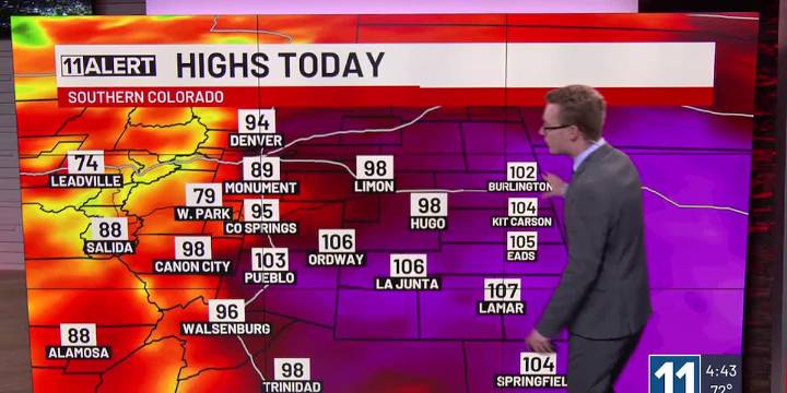
Partly cloudy, breezy and hot Friday.
Storm chances increase behind a cold front this weekend.
Also cool and unsettled early next week.
FRIDAY: Increasing cloud cover, but also increasing winds, gusting up to 35-40 mph from the west. This means temperatures will be back in record territory with 90s and 100s. Heat Advisories are in effect once again from 11 am - 8 pm. An isolated strong or even severe storm is possible later today over the southeastern Plains with winds up to 60 mph.
SATURDAY: After the overnight passage of a cold front, temperatures will be much cooler in the 80s and 90s, and storm chances increase in the afternoon and evening. Some of these could be strong to severe with all modes of severe weather possible, especially from Colorado Springs into the southeastern Pla

 Denver7 News
 The Denver Post
 CBS Colorado
 Colorado Springs Gazette
 The Pueblo Chieftain
 Crooks and Liars