
 KIMT News 3
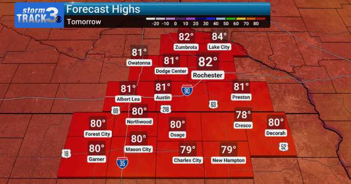
Across northeast Iowa, the chance of heavy rainfall and flooding concerns are front and center through Monday. Although the bigger risk looks to be south into Central Iowa.
The setup for this persistent rain involves several atmospheric disturbances interacting with a slow-moving frontal boundary draped across the region. This boundary is acting like a focused pathway for abundant moisture, leading to rounds of storms and heavy downpours, particularly starting tonight and continuing into Sunday morning. While many storms are expected, we aren't anticipating severe weather up here....but again the best risk of strong storms and heavy rain is mainly well south.
Looking ahead, there's good news as we move into the middle of the upcoming week. As the overall weather pattern begins to shift,

 America News
 Yahoo Canada
 WRAL News
 Columbia Daily Tribune
 Ocala Star-Banner
 Raw Story
 AlterNet
 Essentiallysports Tennis