
 CBS4 Miami
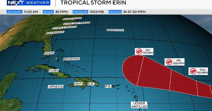
Tropical Storm Erin officially formed in the eastern Atlantic on Monday morning, just west of the Cabo Verde islands.
This system is expected to continue moving west to west-northwest at 15 to 20 mph across the eastern and central tropical Atlantic.
Forecast models have remained consistent on the track continuing west-northwest, staying north of the Leeward Islands over the course of the week.
Early models show the storm is expected to strengthen and could become the first hurricane of the season around Thursday. Some intensity forecasts suggest this could even become a major hurricane by the weekend.
The forecast cone for Tropical Storm Erin. 8/11/2025 NEXT Weather
A number of forecast models show a turn to the north and northeast by the beginning of next week. This has be

 America News
 Local News in Arizona
 KY3
KY3 CNN
CNN CBS News
 KBTX News 3
 NBC News
 AccuWeather Severe Weather
 Axios
Axios The List