
 WREX
WREX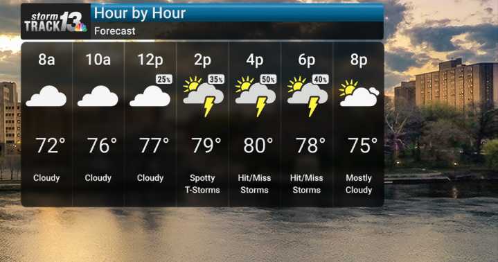
We're kicking off the week with quite a bit of weather to watch. A developing storm system is expected to bring thunderstorms, particularly this morning. For those of you in the northwestern parts of our viewing area, especially northwest of I-55, the threat for strong to damaging winds is greatest early today. We're talking about the potential for severe gusts, and we can't rule out damaging wind events in those specific zones. As the day progresses into the late morning and afternoon, expect scattered thunderstorms to pop up. We're also keeping an eye on the possibility of localized torrential downpours, which could lead to instances of flooding.
Looking ahead to the weekend, we're expecting a noticeable shift as uncomfortable heat and humidity return. Heat indices are forecast to reach

 Associated Press US and World News Video
 MyNorthwest
 Detroit Free Press
 WMTV NBC15
 FOX 13 Seattle King County
 New York Post
 Daily Voice
 10 Tampa Bay
 Delaware Sports