
 Orlando Sentinel
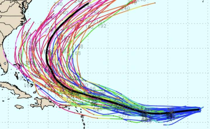
As Tropical Storm Erin churns through the Atlantic on a path toward the U.S. and the Caribbean islands, long-range forecast models are continuing to show a turn to the north before landfall.
But everyone along the U.S. coast, from Florida to New England, should continue to monitor the storm’s track , which will not be near the Caribbean until this weekend, the National Hurricane Center said.
As of 5 a.m. Monday, Erin was still in the east-central Atlantic, moving west at 21 mph with sustained winds of 45 mph. Erin is encountering dry air and mild sea-surface temperatures, which will “keep the small vortex in check,” the hurricane center said.
“Several factors are working in its favor, including lack of dust, warm water and a lack of disruptive breezes (wind shear),” said AccuWeather s

 America News
 KTOO
KTOO Press-Enterprise
 FOX Weather
 The Daily Sentinel
 New York Post
 Spectrum News Louisville
 FOX 5 Atlanta Crime
 CBS News
 The Daily Beast