
 Deseret News
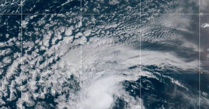
Tropical Storm Erin continued its steady westward march across the Atlantic Ocean on Tuesday, with forecasters warning it could strengthen into the first hurricane of the Atlantic season later this week.
The National Hurricane Center in Miami said on Monday that Erin formed just west of the Cabo Verde Islands, off the coast of Africa, before pushing westward. As of Tuesday morning, its center was located roughly 1,890 miles east of the northern Leeward Islands, packing maximum sustained winds of 45 mph.
Projected path and potential impact
The NHC cautions it’s still too soon to pinpoint Erin’s exact impact on the northern Leeward Islands, the Virgin Islands and Puerto Rico, though the risk has grown since the weekend. There’s “even greater uncertainty” about possible effects in the Bah

 ABC 7 NY
 WFLA
WFLA WESH 2 News
 America News
 KTOO
KTOO Press-Enterprise
 FOX Weather
 New York Post
 The Daily Sentinel
 Spectrum News Louisville
 FOX 5 Atlanta Crime
 Associated Press US and World News Video
 Honolulu Star-Advertiser Traffic