
 The Bay City Times
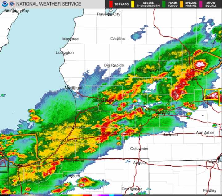
A thick band of storms is marching across the Lower Peninsula Tuesday night. These storms are marked by heavy downpours that have flooded roads and have sparked do-not-travel warnings in at least one part of Mid-Michigan.
One storm in Bay County had a radar-indicated rotation, sparking a brief Tornado Warning from the Nation Weather Service. No touchdown was reported.
These storms are packing lightning and the potential for damaging wind gusts to 60 mph.
Check here to see the always-updated radar image for the state.
Flooded streets have been reported so far tonight in Kalamazoo, Battle Creek and Midland.
Some of the thunderstorm warnings mention the possibility of small hail being carried by these storms.
The line is expected to sweep east toward Detroit and Southeast Michigan by

 America News
 KTOO
KTOO Press-Enterprise
 The Daily Sentinel
 FOX Weather
 FOX 5 Atlanta Crime
 Spectrum News Louisville
 Raw Story
 CBS News