
 The Jersey Journal
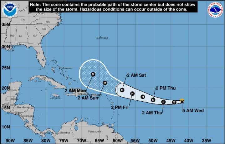
Tropical Storm Erin is expected to become a hurricane in the next two days as it churns in the central Atlantic and could pose risks to Caribbean islands this weekend, according to the National Hurricane Center .
As of Wednesday morning, Erin was located about 1,400 miles east of the northern Leeward Islands, with maximum sustained winds of 45 mph.
The storm is moving west at 20 mph and is forecast to continue west before turning west-northwest.
“Erin has not been able to strengthen significantly for the past couple of days,” the National Hurricane Center said early Wednesday. “However, it is expected that the system’s environment will gradually become more conducive for intensification over the next 48 hours.”
Hurricane forecasters predict Erin reaching hurricane strength by late T

 WESH 2 News
 CBS4 Miami
 America News
 Columbia Daily Tribune
 KTOO
KTOO Press-Enterprise
 CBS News
 FOX Weather
 The Denver Post
 Florida Today
 The Post and Courier
 AlterNet