
 FOX Weather
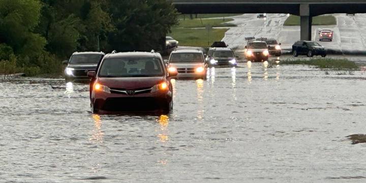
NEW YORK – Showers and thunderstorms pushed through the Interstate 95 corridor Wednesday, producing heavy rainfall and the threat of flash flooding from the mid-Atlantic to the Northeast .
The storms were associated with a nearly stationary cold front draped across the region, which allowed for an influx of Gulf moisture to stream northward.
Rainfall rates of 1-3 inches per hour were possible in the strongest cells, with daily rainfall totals potentially reaching 4 inches in a few communities.
Areas around higher terrain, including the Poconos, the Catskills and the Appalachian Mountains, were especially vulnerable to flash flooding, as runoff can occur more quickly in steep landscapes.
3 DEAD, 1 MISSING AS FLOODING IN SOUTHERN TENNESSEE PROMPTS CHATTANOOGA TO DECLARE STATE OF EMERGENC

 Arizona Republic
 TMJ4 News
 WCNC Charlotte Weather
 KOLO8
KOLO8 The Weather Channel
 FOX News
 America News
 AlterNet