
 WVTM 13
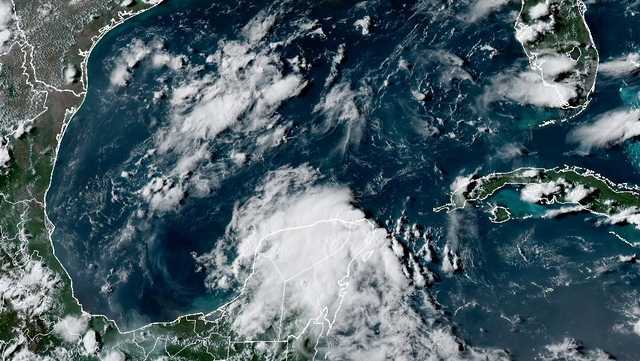
FULL FORECAST | FIRST WARNING LIVE RADAR | | UPLOAD YOUR WEATHER PHOTOS
The National Hurricane Center is tracking a disturbance in the Gulf near Mexico while watching the path of Tropical Storm Erin.
>> Maps and Models: Tracking Erin
We've had five tropical storms so far, but no hurricanes to date in Atlantic. September 10 is historically the peak of hurricane season, so you can expect tropical activity to ramp up in the weeks to come.
A few strong waves will emerge from the African coast in the near future and drift westward through the Atlantic. This is the time of year we watch for these developing storm systems to trek across the Atlantic. They have plenty of time to organize as they move through very warm waters, and the environment becomes even more favorable once

 11Alive
 PBS NewsHour
 Florida Today
 America News
 WTAJ-TV
 NBC News
 CBS News
 AccuWeather Severe Weather
 WRCB-TV
 TMJ4 News
 Raw Story