
 CBS Colorado
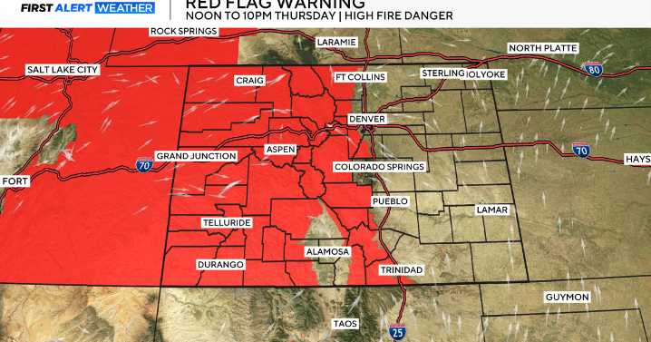
The combination of near record heat, extremely low humidity and dry, gusty thunderstorms will create a fire danger situation for more than half of the state on Thursday.
Our near record heat wave continues into Thursday with lots of highs over the Eastern plains and Western Slope rising into the 90s and 100s!
While at the same time relative humidity levels will be super low for the second half of the week with the drier and hotter air moving in.
At the same time there is just enough moisture flowing in from down south that high-based dry, gusty storms are expected to form late in the day. These types of t-storms don't drop much rain but, do create gusty winds and lightning.
As a result, a RED FLAG WARNING is posted for all of the Western Slope, Colorado Mountains and the Front Range Fo

 KWWL
KWWL New Jersey News
 KOMU 8
 Fosters Daily Democrat
 AccuWeather Severe Weather
 The Daily Bonnet
 14 News Sports
 America News
 AlterNet
 Nicki Swift