
 WKYT
WKYT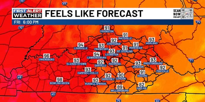
LEXINGTON, Ky. (WKYT) - We’ve got another round of scattered showers and booming storms on tap today before a blast of heat kicks in. By the weekend and early next week, temps are pushing into the 90s—then a dip in the jet stream later next week should bring in some much nicer air.
In the short term, it’s all about those pop-up storms. Just like the past few days, any storm that develops could dump heavy rain in a hurry, which means local flash flooding is possible. They’ll also come loaded with lightning, so keep an eye on the sky.
Friday brings fewer storms—just a few roaming around in the afternoon and evening. Highs today and Friday will land in that 85–90° range for most spots.
Over the weekend, storm chances shrink even more while the heat cranks up into the 90–95° range. The good

 WYMT
WYMT WAVE 3 News
 Post Register
 AlterNet
 Atlanta Black Star Entertainment
 America News
 Seeking Alpha Stock