
 NOLA
NOLA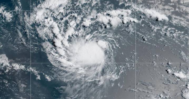
Tropical Storm Erin is expected to enter warming waters and become a hurricane by Friday afternoon, forecasters with the National Hurricane Center in Miami said on Thursday.
As of 4 a.m., Erin was 990 miles east of the northern Leeward Islands and had maximum winds of 50 mph. The tropical storm continues to move west at about 17 mph, said NHC forecaster Larry Kelly.
Kelly said the increasingly favorable conditions will bring rapid intensification in the next 24 to 48 hours. Erin is forecast to become the Atlantic Ocean's first hurricane of the 2025 season .
After becoming a hurricane, Erin will continue to intensify Friday and Saturday, becoming Category 3 strength by Saturday, forecasters said.
The tropical storm currently poses no threat to land. It is forecast to continue moving

 America News
 Kitsap Sun
 WTAJ-TV
 NBC News
 Ocala Star-Banner
 AccuWeather Severe Weather
 CBS News