
 WEIS Radio
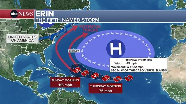
(NEW YORK) —Tropical Storm Erin is forecast to strengthen into the first hurricane of the Atlantic season by Saturday morning and then become a major Category 3 hurricane by Sunday morning as it passes north of Puerto Rico.
But as of now, Erin is not expected to pose a direct threat to the U.S.
Puerto Rico can expect 1 or 2 inches of rain from Erin’s outer bands, as well as dangerously rough surf and a high risk of rip currents this weekend and into early next week.
After moving north of Puerto Rico, Erin is forecast to turn north.
The vast majority of meteorological modeling has Erin remaining over the ocean between Bermuda and the East Coast, passing by Bermuda around Wednesday.
While a landfall in the U.S. isn’t expected, there is a chance Erin could bring a few light rain showers

 WWSB
WWSB The News-Star
 Newsday
 New York Post
 ICE News
 Daily Voice
 CBS News
 Associated Press US News
 Law & Crime
 The Atlanta Journal-Constitution Sports