
 WWSB
WWSB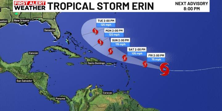
SARASOTA, Fla. (WWSB) - Tropical Storm Erin is expected to become a hurricane Friday in the central Atlantic, strengthening into a major hurricane over the weekend.
Current forecasts turn Erin northwest and then north early next week, keeping the center well offshore.
What it means for Florida & the Suncoast
Minimal to no direct impacts
A shift to northeast winds and slightly drier air by late next week
No big surf or rip current threats expected for the west coast
A modest rip current risk possible on the east coast next week
If Erin were to delay that turn to the north, impacts could increase, especially for Florida’s east coast, but right now, the odds strongly favor a “look but don’t touch” scenario for the Sunshine State.
If Erin stays on its current track, our weather story w

 WFMY News 2
 Florida Today
 CBS News
 News Collection
 5 On Your Side Sports
 New York Post Opinion
 Raw Story
 Breitbart News
 CNA Entertainment
 Cinema Blend