
 KOLR10 News
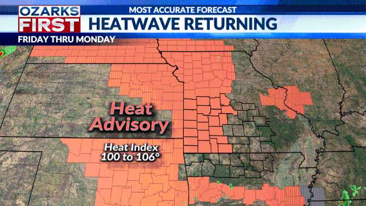
Well, I'm sure you've already noticed, but the heatwave has officially arrived. Temperatures climbed into the mid-90s today under mostly sunny skies, and unfortunately, it’s only going to get hotter from here.
Highs are expected to flirt with the triple digits each day through the end of the week, with this heatwave potentially delivering the hottest temperatures we've seen in 2025 so far.
The National Weather Service has issued a heat advisory for all counties along and west of Highway 65. The advisory goes into effect at noon tomorrow and is set to remain in place through at least Monday evening, though it will likely be extended into Tuesday.
Afternoon heat index values will range from 100 to 106 degrees, making outdoor activity especially dangerous during peak hours.
Some relief is

 Associated Press US and World News Video
 Fox 11 Los Angeles Sports
 KWQC
KWQC WRCB-TV
 Rolling Stone
 Raw Story
 Daily Herald Sports
 The List