
 ClickOrlando
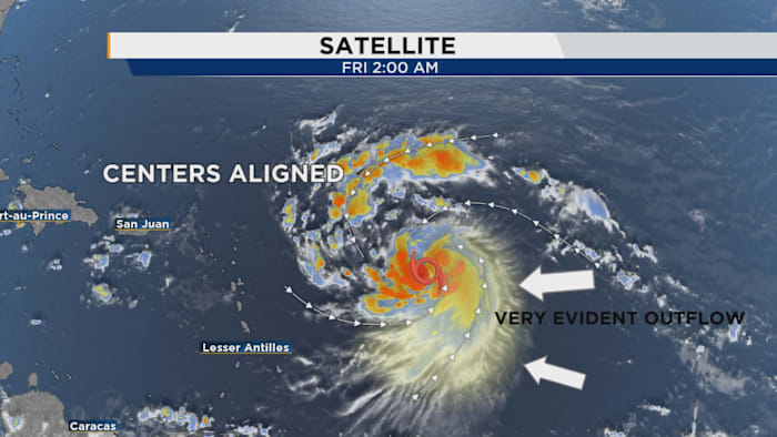
Erin has been a very interesting storm to track up to this point. It’s one of our first legitimate long-track features in a while.
Long-track simply means it splashed down off the west coast of Africa and immediately started to organize.
Last hurricane season, we had a few instances of these tropical waves that showed signs of development shortly after leaving the shores of Africa, but they immediately curved up toward the north before they could really cover some real estate across the Atlantic basin. After shedding some of the sustained thunderstorms we saw much of the day yesterday, we're seeing a fresh batch firing up right around the vortex center. This is a clear sign Erin is about to strengthen into a hurricane (Copyright 2025 by WKMG ClickOrlando - All rights reserved.)
We

 Rockford Register Star
 The News-Star
 News 5 Cleveland
 America News
 Orlando Sentinel
 Associated Press US and World News Video
 Florida Today
 Arizona's Family
 TMJ4 News
 NBC News
 FOX 10 Phoenix Health
 PC World