By Joe Lombardi From Daily Voice
Erin has just become first hurricane of the 2025 Atlantic season.
The National Hurricane Center made the announcement in its 11 a.m. update on Friday, Aug. 15.
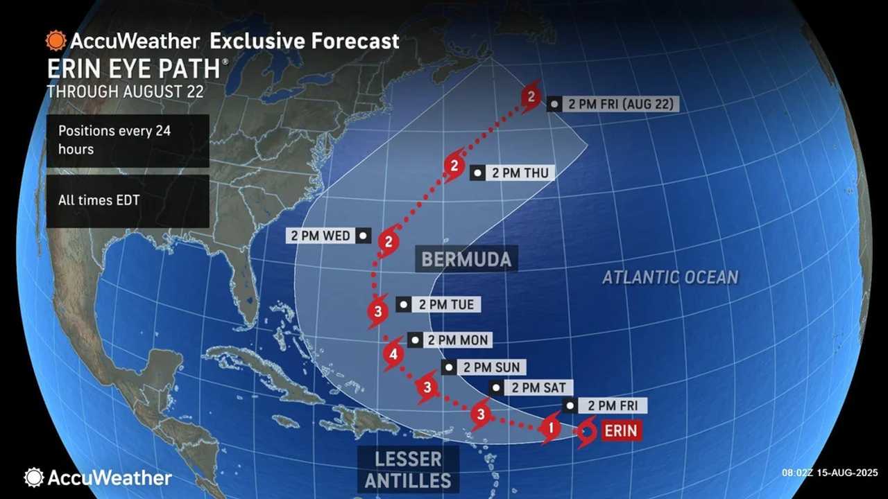
Erin, which started the day as a tropical storm, is churning north of Puerto Rico, with its projected path steering between Bermuda and the US East Coast, and the core expected to pass near or north of the Leeward Islands on Saturday, Aug. 16.
Forecasters caution that Erin’s exact track remains uncertain, but even a glancing blow could bring damaging winds, coastal flooding, and heavy rain to eastern North Carolina, Long Island, and southeastern New England.
Bermuda is also in the potential impact zone, with hurricane conditions possible by midweek.
Already, Erin’s expanding wind field is generating dangerous surf and rip currents across the northeastern Caribbean, with beachgoers from Florida to Atlantic Canada urged to exercise caution through the weekend.
"Two tropical waves expected to push across the Atlantic later this month, following a similar route to Erin, will be closely monitored," AccuWeather Lead Hurricane Expert Alex DaSilva said.
Check back to Daily Voice for updates.

 Daily Voice


 WESH 2 News
 WFMY News 2
 PIX11 News
 Honolulu Star-Advertiser Traffic
 Reuters US Business
 New York Daily News
 ABC News
 People Crime
 Tribune Chronicle
 New York Post
 IMDb Movies