
 WBAL NewsRadio
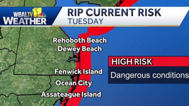
The National Weather Service issued tropical storm watches along the Mid-Atlantic coastline as tropical storm force winds and hazardous seas could capsize or damage vessels and reduce visibility as a result of Hurricane Erin.
SCHOOL CLOSINGS AND DELAYS | WEATHER MAP | TRAFFIC | HOURLY FORECAST
NATIONAL HURRICANE CENTER ADVISORY — 11 a.m. | Aug. 19
– Hurricane Erin: Category 2
– Location: 25.6 N 72.4 W
– About 650 miles SW of Bermuda and 690 miles SSE of Cape Hatteras, North Carolina
– Maximum sustained winds: 105 mph
– Movement: NW at 9 mph
– Minimum central pressure: 961 mb
Hurricane-force winds extend outward up to 80 miles from the center and tropical-storm-force winds extend outward up to 205 miles.
» HURRICANE PREPARATION: How to prepare for hurricanes
Erin reached hurrican

 Daily Voice
 The Greenville News
 WYMT
WYMT Newsday
 KAKE
KAKE WMTV NBC15
 PBS NewsHour World
 Raw Story