
 The Grand Rapids Press
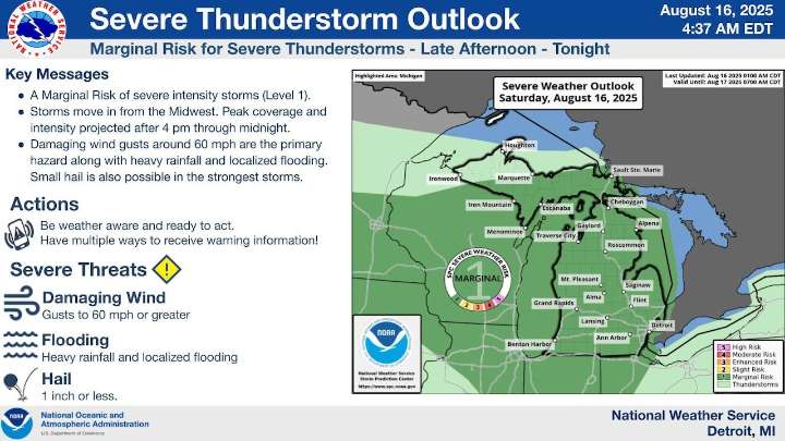
After storms moved across the northern part of Michigan early today, another round of what looks to be heavy rain and thunderstorms is heading toward us for the afternoon and evening.
Some of these Saturday storms could have damaging wind gusts up to 60 mph, the National Weather Service said. Downpours and localized flooding are also possible if the high rain amounts associated with this system hold up as it crosses Lake Michigan and sweeps into a wide area of the state later today.
You can see the always-updated radar on our MLive weather page here.
Most of Michigan is under a “marginal” risk of severe weather today, as shown in the darker green color on the National Weather Service map above.
The timeline for today’s uptick in severe weather chances is roughly 4 p.m. to midnight. In

 The Advocate
 KPLC
KPLC KOMU 8
 WKOW 27
 Daily Herald
 WDSU New Orleans
 Associated Press Top News
 KPTV Fox 12 Oregon
 WABI
WABI Raw Story