
 WIS News 10
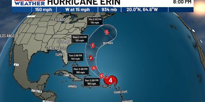
COLUMBIA, S.C. (WIS) - Hurricane Erin continues to track just north of the Leeward Islands as a category 4 storm with maximum sustained winds of 150 MPH.
Erin has been downgraded from a category 5 to a category 4 this evening as it undergoes an eyewall replacement. When this happens, a hurricane will typically briefly weaken. It’s still forecast to make a turn to the north by Monday and Tuesday, keeping the powerful hurricane away from the East Coast. The threat of seeing direct impacts remains low, but there is still the likelihood of dangerous rip currents and surf to the beaches this upcoming week.
For now, it is something we’re watching closely in the First Alert Weather Center. Erin serves as a friendly reminder that we’re approaching the peak of the Atlantic Hurricane season. Altho

 The Greenville News
 The Post and Courier
 The Motley Fool
 RealClear Politics
 America News
 FOX 5 Atlanta Crime
 The Travel