
 KDKA
KDKA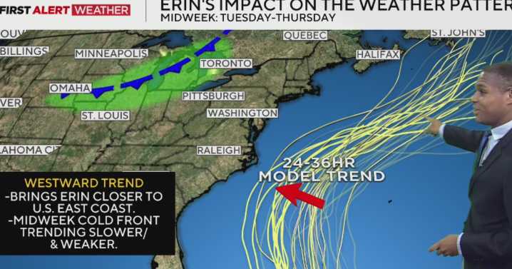
Some rain is moving into parts of the Pittsburgh area to end the weekend, but the bigger forecast outlook for the week includes possible impacts from Hurricane Erin.
(Photo Credit: KDKA Weather Center)
After a high of 91 degrees on Saturday, temperatures remained very warm through the overnight hours with most spots hovering in the mid-60s to low 70s through Sunday morning. Moisture levels are also higher ahead of a weak cold front that will bring a scattering of showers and storms to western Pennsylvania mid-morning through early afternoon.
Radar shows a cluster of thunderstorms moving across Lake Erie before sunrise. This will likely pass through some of our I-80 counties and possibly as far south as Route 422 from just after sunrise through 10-11 a.m. The actual cold front still lags

 Daily Voice
 ABC57 News
 NBC10 Philadelphia
 ABC News Weather
 The Mercury News
 KTRE 9 News
 Atlanta Black Star
 The Telegraph