
 The Advocate
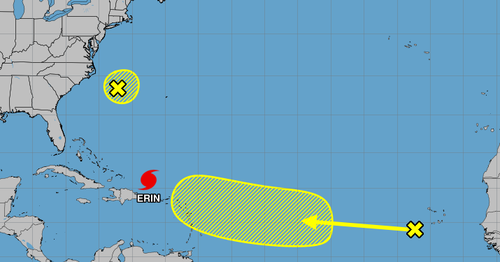
Hurricane forecasters continued to track a tropical wave off the coast of Africa Sunday morning as Hurricane Erin weakened to a Category 3 storm following an eyewall replacement cycle.
The wave near Cabo Verde was producing disorganized showers and thunderstorms and moving west-northwest across the Atlantic as of 7 a.m. Sunday, according to the National Hurricane Center. Some gradual development of the system is possible during the middle of the coming week, and forecasters gave it a 20 percent chance of forming into a tropical depression or storm within the next seven days.
Forecasters first highlighted the wave Saturday night, after Hurricane Erin exploded in strength, rapidly intensifying from a tropical storm to Category 5 hurricane in a single day. Rapid intensification is defin

 WKOW 27
 Associated Press Top News
 The Oregonian Public Safety
 New York Post
 KPLC
KPLC Daily Herald
 FOX 4 News Arlington
 First Alert 4 News
 Crooks and Liars