
 TIME
TIME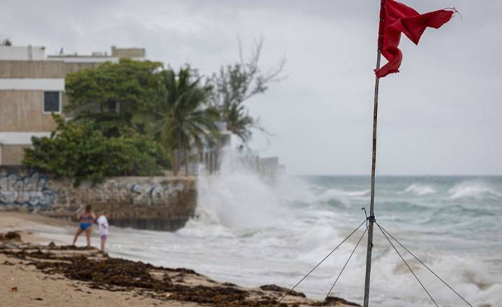
Hurricane Erin is ripping through the Atlantic Ocean, passing just east of the Turks and Caicos and southeast Bahamas on Aug. 18 and 19, bringing coastal flooding to the islands.
While the category 4 storm is not expected to make landfall on the U.S. east coast, it will have an impact nonetheless. Dangerous high surf and rip currents are expected from Florida to New England throughout the week.
“It looks like it's going to stay offshore through its entire lifetime, but because it's so large in size, it is going to be bringing impacts,” says Alex DaSilva, AccuWeather’s lead hurricane expert.
The hurricane saw an “exceptionally rare” rapid intensification—growing from a tropical storm to a category 5 hurricane in 24 hours on Saturday. (The storm has since been downgraded to a category 4.)

 Local News in South Carolina
 FOX 13 Tampa Bay Crime
 FOX 51 Gainesville Crime
 Orlando Sentinel
 FOX 13 Seattle Crime
 America News
 WCNC Charlotte Weather
 KRWG Public Media
 Sarasota Herald-Tribune
 Daily Kos