
 CBC News
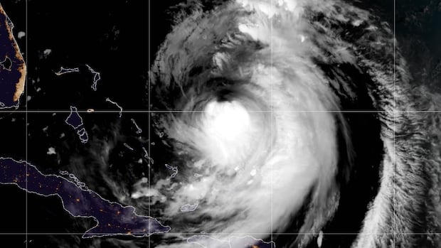
Hurricane Erin will bring some wind and strong waves to the Atlantic region over the next few days, but will likely be too far offshore to bring rain to the region.
As of Tuesday morning, Erin was a Category 3 hurricane, and is set to curve northward over the next few days.
CBC meteorologist Ryan Snoddon said there continues to be good agreement among the forecasting models that the hurricane will track south of the Maritimes and Newfoundland this weekend.
Tropical storm-force winds are expected to remain offshore as Erin passes through the area. (NOAA)
However, the storm is expected to grow in size over the next two to three days and will be very large as it tracks through the region.
Even though the centre of the storm will likely be well to the south, Atlantic Canada may still fe

 America News
 IMDb TV
 CBS Sports Golf
 Futurism
 The US Sun Travel
 AlterNet