
 WIS News 10
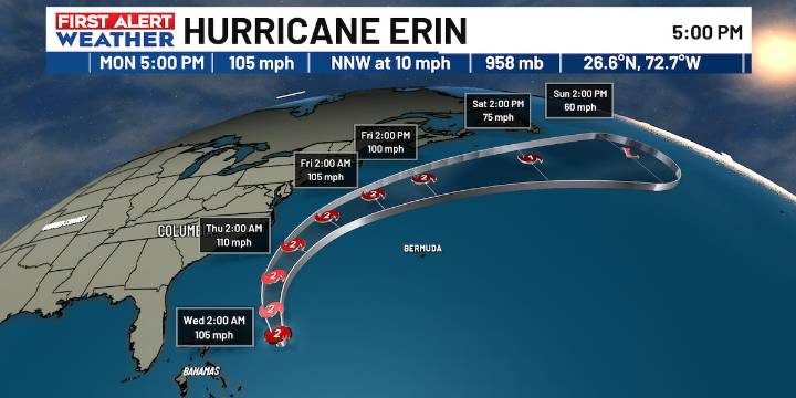
COLUMBIA, S.C. (WIS) - Erin has maintained its strength this evening, with max sustained winds of 105 MPH, making it a Category 2 Hurricane.
There haven’t been any major changes to the forecast track. Direct impacts to the East Coast from Erin are still unlikely as the core stays well offshore. However, dangerous rip currents and high wave heights leading to rough surf are expected along the beaches of the East Coast. There’s a high surf advisory in effect until 8 PM Thursday.
Far outer bands of Erin may bring some gusty winds to the beaches of the Carolinas. There’s a very low (5%) chance of Tropical Storm force winds in Horry County. Better chances for strong winds can be found in the Outer Banks of North Carolina, where Tropical Storm Watches are in effect.
For now, it is something w

 Local News in South Carolina
 Raw Story
 The Babylon Bee
 America News