
 CBS Philly
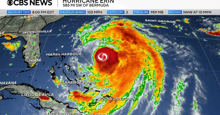
Hurricane Erin continues its northerly track and will deliver impacts here in the Philadelphia region, mainly at the shore. While the heart of the storm will likely stay well offshore (fortunately), we will have several impacts locally, especially along the Jersey Shore and Delaware beaches. These impacts will peak Wednesday and Thursday. Here's what to know:
High rip current risk will continue through at least Friday
Long period swells will generate rough surf and large breaking waves
8-12 foot seas on Wednesday that could build as high as 10-15 feet Thursday
Dangerous swimming and boating conditions all week
Beach erosion and coastal flooding are likely. There's already a coastal flood advisory for the Jersey Shore and Delaware in place on Tuesday.
CBS News Philadelphia
In addi

 CBS4 Miami
 CBS Boston
 America News
 The Columbian
 CNN
CNN FOX 13 Tampa Bay Crime
 KRGV Rio Grande Valley
 Bonner County Daily Bee
 MyNorthwest
 TMJ4 News
 The Travel
 New York Post