
 WJZ CBS Baltimore
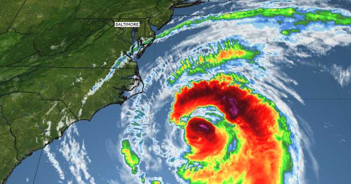
Marylanders are waking up to another cloudy, damp day as a slow-moving front lingers just south of the state. That alone would be enough to keep skies gray and temperatures unseasonably cool, but it's Hurricane Erin that's commanding the most attention along the Chesapeake Bay and Atlantic coastline.
With sustained winds near 100 mph, Erin made its closest pass to southern Maryland this morning. While Erin is staying offshore, its large wind field and powerful seas are having a major effect here at home. Tropical Storm Warnings are in effect for Maryland's coastal waters and the Chesapeake Bay, where the most hazardous conditions are expected through this evening.
Northeast winds are already gusting between 30 and 40 mph, with even stronger gusts topping 45 mph possible over the lower Ch

 The Washington Post
 NBC4 Washington
 The Baltimore Sun
 America News
 Local News in North Carolina
 CBS News Video
 WCNC Charlotte Weather
 AccuWeather Severe Weather
 People Human Interest
 KPTV Fox 12 Oregon