
 WJZ CBS Baltimore
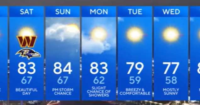
Clouds will clear as Hurricane Erin continues to drift farther offshore. Temperatures will settle into the upper 50s and 60s under a gradually clearing sky.
Hurricane Erin, while well out to sea, is still creating issues along Maryland's shoreline. Coastal flooding is expected along the western shore of the Chesapeake Bay and Worcester Co. during the next few high tide cycles. At the beaches, rough surf and dangerous rip currents will persist through the weekend, with minor beach erosion possible in Ocean City and other coastal spots.
By Friday, high pressure builds in, bringing sunshine and much lower humidity. Dew points will dip into the 50s, making it feel more like early fall than late August. Afternoon highs will top out in the upper 70s to low 80s, followed by a crisp night with l

 NBC News
 Fox 11 Los Angeles Sports
 Associated Press US and World News Video
 WTOC 11
 New York Post
 FOX 10 Phoenix Latest
 KTVU San Francisco
 WAFB
WAFB WFTV Channel 9
 Fit&Well