
 Click2Houston
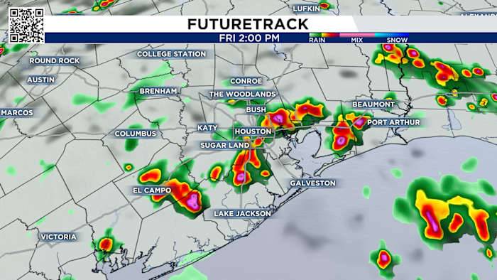
If you thought Thursday’s storms were intense, Friday is shaping up to be very similar for Southeast Texas.
A stubborn boundary stretched along I-10 is once again expected to spark strong thunderstorms, making for another active weather day.
By 7 a.m. Friday, coastal showers may roll through, with the possibility of thunderstorms to the north.
Check out the radar below:
Friday’s forecast:
The primary threat is street flooding.
Later in the day, starting around 1 p.m., the Houston area is forecast to see scattered, strong thunderstorms. This time, the storms could be more widespread, prompting a 60% chance of storms—higher than Thursday’s odds.
Storms earlier this week packed 40 mph winds and hail, so it’s a good idea to keep an eye on conditions.
Flood risk across most of Southeast

 PaperCity Magazine
 FOX 4 News Arlington
 101.5 KNUE
 Cover Media
 Washington Examiner
  CNN
CNN PennLive Pa. Politics
 Vogue Living