
 Spectrum News Louisville
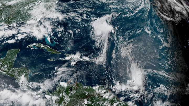
Tropical Storm Fernand formed in the western Atlantic on Saturday afternoon. It's the sixth named storm of the 2025 Atlantic hurricane season.
Fernand has maximum winds of 40 mph and is moving north at 15 mph. It's expected maintain a north and northeast trajectory over the next few days.
It will encounter favorable conditions to strengthen, and could possibly becoming a category one hurricane, before becoming post-tropical.
It's likely that is passes near Bermuda, and Tropical Storm Watches or Warnings could be issued by Sunday.
Forecast models keep Fernand well off the U.S. east coast, impacting Bermuda and then accelerating into the north Atlantic by Tuesday.
You can track the rest of the tropics here.
Our team of meteorologists dives deep into the science of weather and breaks d

 CBS4 Miami
 SouthCoastToday
 WDSU New Orleans
 New York Post
 The US Sun Latest
 Denver7 News
 Bozeman Daily Chronicle
 CNN
CNN Gainesville Sun
 Major League Soccer