
 News4JAX
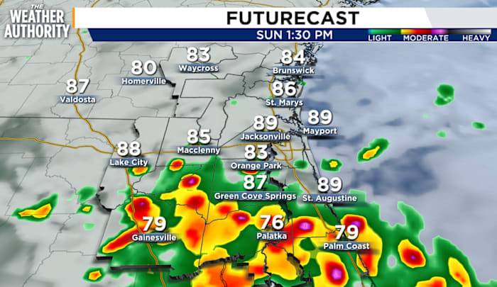
Sunday will be another day of strong to severe weather as the stalled frontal boundary makes its exit southward through our southern counties. Areas south of I-10 will likely experience heavy downpours, gusty winds, and frequent lightning throughout the day. Expect more rainfall totals in already saturated areas of Northeast Florida.
High rip current risk continues along our Northeast Florida beaches through late tonight.
Mostly cloudy skies will allow for only pops of sunshine during the day, keeping temperatures in the upper 80s. A bit of a warm-up and drying-out period starts on Monday.
Cooler, fall-like temperatures are in the forecast for later in the week as we approach Labor Day weekend.

 The Washington Post
 ABC News Weather
 Essentiallysports Football
 New York Post
 Associated Press US News
 WITN-TV
 KSNB Local4 Central Nebraska
 WKOW 27
 The Daily Beast