
 ABC57 News
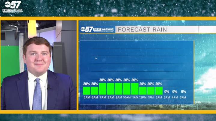
To view this video please enable JavaScript, and consider upgrading to a web browser that supports HTML5 video
A few more lake effect rain showers will turn up in the first half of the day and move southeastward with time. The breeze accompanying the rain will disrupt widespread and dense fog, although a few patches of low visibility are possible. Our Tuesday gets gradually sunnier and warmer than yesterday with highs expected land in the low 70s for most of Michiana. High pressure builds in late tonight and most of tomorrow, clearing out cloud cover and raising temperatures into the mid 70s on Wednesday. The warm and quiet weather is short-lived, however, as a subsequent surface low likely brings in a cold front early Thursday that forces widespread rain showers and a cooldown.
Today:

 Detroit Free Press
 Tampa Bay Times Health
 AlterNet
 Edmonton Sun World
 Orlando Sentinel Entertainment
 AmoMama
 TODAY Health