
 WWSB
WWSB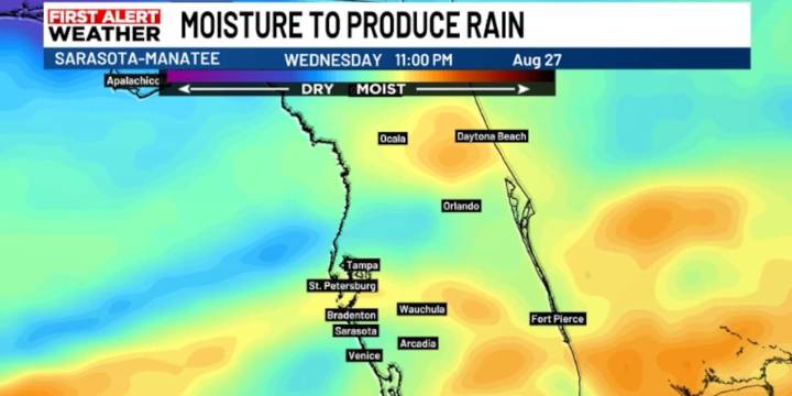
SARASOTA, Fla. ( WWSB ) - A weak cold front has slipped south across the state and will be moving into southern Florida later today. North of this line, the air has already turned noticeably drier with only a slim chance for a stray shower. South of the Suncoast this morning conditions remain more humid, and scattered showers and storms will continue through the day. As the front sinks south it will gradually lose its punch. A front this far south, at this time of year is a bit unusual. Its impact will be to reduce our rain chances today.
As the front washes out overnight, our weather pattern begins shifting back toward a more typical Florida summer setup.
On Thursday and Friday, winds will turn out of the southwest, steering most storms inland and toward the east coast during the afte

 Sun Sentinel
 FOX 13 Tampa Bay Crime
 Florida Politics
 Raw Story
 AlterNet
 NECN Politics
 Reason