
 WBRC
WBRC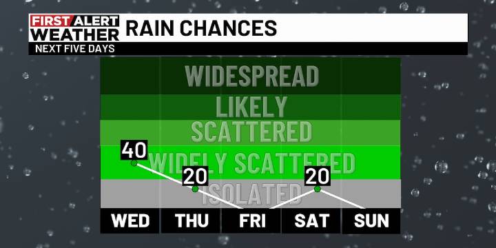
BIRMINGHAM, Ala. ( WBRC ) - THE NEXT 24 HOURS : We are tracking more showers and storms Monday evening moving southeast across the area. We could see some additional development throughout the night with a partly to mostly cloudy sky and lows in the 60s. Highs will rebound into the 80s again on Wednesday, and we could see a few isolated showers and storms, although forecast guidance has trended a bit drier for Wednesday afternoon.
THE NEXT BIG THING : Long-range guidance continues to show a push of cooler and drier air over the eastern United States this weekend. The core of coolest air looks to remain north of our area, although we will see a nice drop in muggy levels by Sunday. Until then, the summer heat hangs on, with highs in the 80s and lows in the 60s. There will be a lingerin

 The Washington Post
 The Oregonian Public Safety
 WCBI-TV
 FOX 11 Riverside County
 WWSB
WWSB FOX Weather
 People Shopping