
 KSNB Local4 Central Nebraska
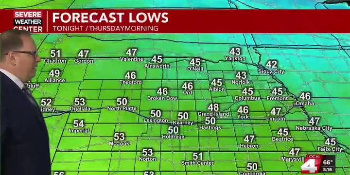
HASTINGS, Neb. (KSNB) - Good Wednesday evening everyone! A cold front that passed through earlier today will usher in not only chilly temperatures for tonight, but also Canadian wildfire smoke. A second front Thursday night will usher even cooler air for the weekend.
This evening will feature partly to mostly cloudy skies with areas of smoke. The highest concentration of smoke at the surface looks to stay in the eastern half of the state where we have air quality alerts in place until late Thursday morning. Later tonight, some low-level moisture may return over western parts of the area along a warm front that will press eastward with time. This could lead to some thicker clouds and perhaps some areas of fog. Low temperatures overnight will dip to between the mid 40s northeast and the mid

 KLKN-TV Lancaster County
 The Spectator
 Nicki Swift
 America News
 WFMJ-TV Entertainment
 WFMJ-TV Sports