
 KIMT News 3
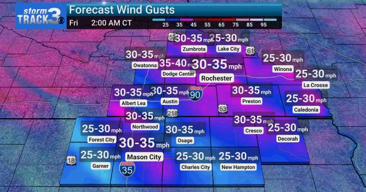
(KIMT) -- Are you liking the chill? You better get used to it because it will not be going away until next week! Even with a southerly wind shift Thursday, temperatures will not rebound as much as some would like. Expect high temperatures in the low to mid 60s in SE Minnesota, while North Iowans may be able to squeak into the upper 60s in spots.
Clouds will be on the increase Thursday afternoon ahead of our next weather maker. A low pressure system will dive southeast out of Canada Thursday afternoon, eventually reaching us by the evening. An associated cold front will usher in our next wave of rain and rumbles with around 0.25" of rain expected to fall.
After the initial passage of the boundary, STRONG northwest winds will return Thursday night. Winds will gust up to 40 MPH at times thr

 CBS News
 WSMV 4 Nashville
 WYMT
WYMT New York Post Video
 Sarasota Herald-Tribune Sports
 Slate Politics
 The List
 Major League Soccer