
 NBC Right Now News
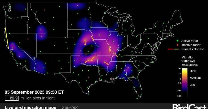
ITHACA, N.Y. — New radar maps from the Cornell Lab of Ornithology show real-time nocturnal bird migration across the United States.
The maps use the national weather radar network to chart bird movements between sunset and sunrise. Brighter colors mark higher traffic rates, measured as the number of birds crossing a kilometer each hour. Arrows show flight directions, while dots mark radar stations with or without available data.
Researchers note that mountainous areas such as the Rockies often appear empty due to radar obstructions rather than an absence of migration.
The BirdCast project, developed with support from NASA, the National Science Foundation and other partners, provides the maps to help scientists and the public better understand migration patterns.
Watch a live migration

 Canadian Geographic Wildlife
 Ocala Star-Banner
 New York Post
 KCRA News
 Associated Press US and World News Video
 YubaNet
 The Advocate
 The US Sun Technology
 Bangor Daily News
 Axios
Axios