
 Eyewitness News 3
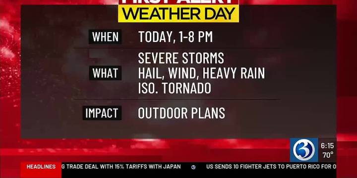
For any Alerts in effect for CT, click: here .
THIS AFTERNOON...
Today is a *First Alert Weather Day* as a cold front will bring the threat for strong to severe storms from the afternoon into the evening hours. There is a Severe Thunderstorm Watch in effect for all of the state with the exceptions of New London County. Storms that develop could produce frequent lightning, heavy rain, a damaging wind up to 70mph, and perhaps hail --- as they move from west to east across CT. Isolated rain totals of 1-2″, locally more in a few spots, could cause poor drainage flooding, especially in western CT. Within the region, storms could rotate leading to the possibility of an isolated tornado. Before the front arrives, expect a muggy day with highs between 80 and 85.
TONIGHT...
Beyond sunset the

 MassLive
 CBS News
 FOX Weather
 CBS Sacramento CBS13
 FOX 10 Phoenix Latest
 Local News in California
 Savannah Morning Sports
 Raw Story
 NBC News NFL