
 FOX 8 News
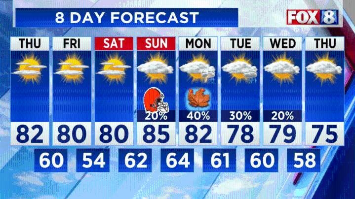
(WJW) -- Clear, cooler and quiet overnight with temperatures in the lower to mid 50s in the cities and upper 40s in the outlying areas. There could be some patchy fog.
This stretch of sunny, warm September weather will continue the rest of the week. The culprit for our fantastic stretch of weather… an upper-level ridge that has been anchored overhead all week. Carbon copy day tomorrow with some patchy fog possible east in the morning.
Next up, a weak front drops in early Friday with hardly any rainfall. Expecting cloud cover in the morning with maybe a stray sprinkle as it drifts south in the afternoon.
Looking ahead, there’s a small opportunity of isolated thunderstorms as a front approaches Sunday evening. The best chance of rain will come on Monday and Tuesday.
Rainfall Futurecast:

 FOX 5 Atlanta Crime
 FOX 5 DC
 NECN Providence
 Arizona's Family
 Buckrail
 FOX Weather
 The Daily Beast
 Vogue
Vogue NBC Chicago Entertainment