
 West Kentucky Star
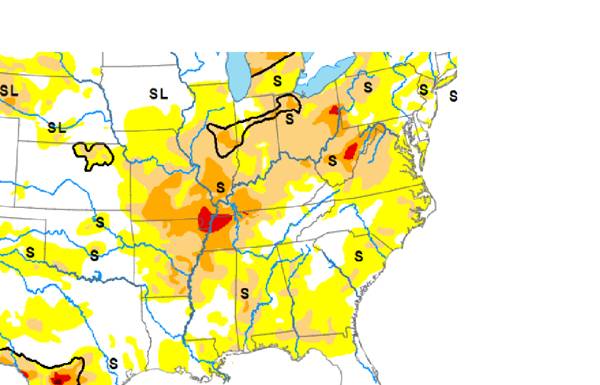
The latest USDA drought monitor shows nearly our entire region under severe drought conditions, and now a portion of the quad state has entered extreme drought.
This week's map issued Thursday has expanded D-2 coverage (level 3 out of 5) for virtually all of southern Illinois and western Kentucky.
Meanwhile, the driest part of the central U.S. is expanding here in the lower Ohio Valley.
Our first taste of extreme D-3 drought (level 4 out of 5) has been established in much of southeast Missouri, northwest Tennessee, and a narrow strip of Kentucky in the southwest corner along the Tennessee border.
Burn bans have been in place for all westernmost Kentucky counties, and many communities in southern Illinois. Fires involving farm equipment and fields have been occurring, and will still be

 Press of Alantic City Business
 The Weather Channel
 WAVE 3 News
 Spectrum News Louisville
 Murray Ledger
 New York Post Video
 CNN Politics