
 KSNB Local4 Central Nebraska
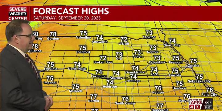
HASTINGS, Neb. (KSNB) - Good Friday evening everyone! The chance for scattered showers and thunderstorms will continue through midnight mainly from the Tri-Cities and areas to the south and east. While we did have a severe storm move through the Kearney area earlier, the severe weather threat looks to stay well off to our south into central Kansas for the rest of the evening. Skies will remain mostly cloudy overnight with light winds. Areas of fog are possible tomorrow morning. This will be especially true for locations that see rain this evening. Lows tonight will dip back into the mid 40s west to mid 50s east.
Mostly cloudy skies will stick around into tomorrow. Low stratus clouds will help to keep temperatures rather cool tomorrow. Highs temperatures tomorrow afternoon will climb into

 KOMU 8
 AccuWeather Severe Weather
 NBC Connecticut
 FOX 32 Chicago
 The Burlington Free Press
 Fox 26 Liberty County
 Nogales International
 TheYoungTurks Video