
 KTIV News 4
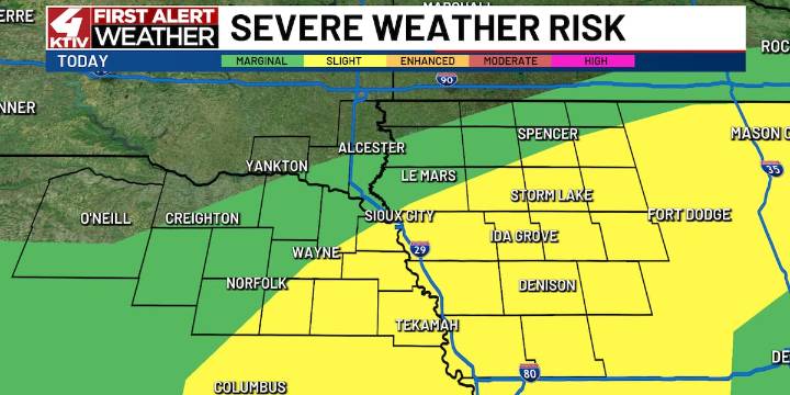
SIOUX CITY (KTIV) - Southern and eastern Siouxland are in a Slight Risk for severe weather.
TODAY
Monday will be warm and muggy with thunderstorms developing in the afternoon along a stationary front in Northern Siouxland. Storms will meander southward through the evening and early overnight.
Main threats will be large hail to ping pong ball size and 60 to 70 mph winds. A tornado is not overly likely, but a brief one can’t be ruled out.
Daytime highs in the low 80s.
TONIGHT
Isolated storms will slowly fade throughout the night with some clearing by early morning. Patchy fog is possible in places that clear out. Overnight lows in the upper 60s.
TOMORROW
Generally dry on Tuesday with a small chance of a very isolated shower or thunderstorm. Highs in the middle 70s and partly cloudy.
 FOX 61 Weather
 Raw Story
 The Daily Bonnet
 AlterNet
 CNN Climate
 FOX News
 CBS Colorado Politics
 OK Magazine
 Scientific American Health
 CBS News World