
 7News Boston WHDH
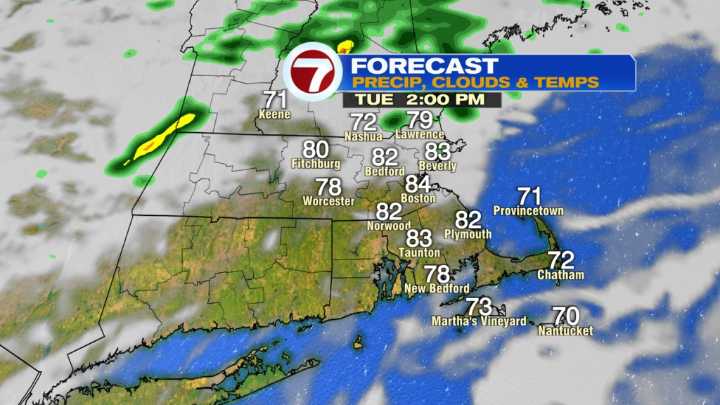
After a few days in a row of beautiful Fall weather, we bring summer warmth and humidity today as highs head for the lower 80s for many. We also increase the chance of showers and storms later today too. Initially, this afternoon, the highest chance will be across northern Mass and southern NH, then shift farther south near days end.
Fair game for anyone to pick up on some wet weather overnight. The unsettled pattern will continue over the next few days with spotty showers and a cooler airmass tomorrow. Then another wave of rain moves in Thursday into Thursday night. Overall, it’ll be beneficial with many spots capable of seeing 1-2″ through the end of the workweek.
Shower chances are lower Friday into Saturday, in fact much of the weekend looks dry with highs returning into the 70s. Sun

 FOX 5 Atlanta Crime
 Dakota News Now
 KRON4 News Bay Area
 The Mercury News
 KSLA News
 FOX Weather
 KSNB Local4 Central Nebraska
 FOX 4 News Arlington
 Eyewitness News 3
 ABC News Weather
 NBC News