
 Kalamazoo Gazette
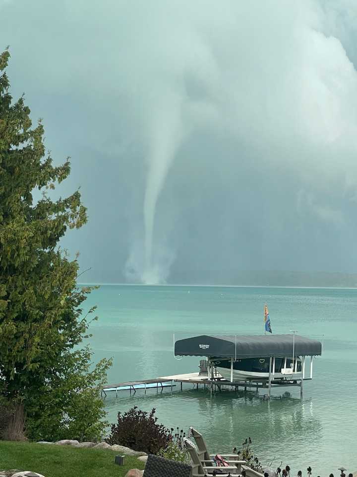
Just one isolated supercell thunderstorm produced three tornadoes yesterday, September 22.
The tornadoes formed in a line from west of Traverse City to Torch Lake and Bellaire.
The National Weather Service(NWS) storm survey team out of Gaylord went and looked at the areas where tornadoes were reported.
The first tornado was a very short-lived twister three miles east of Lake Ann, which is southwest of Traverse City. The tornado path was only around 500 feet long, and the tornado was only 30 feet wide. The NWS gave this very weak twister a rare rating of an EF-U. This means it had an unknown peak wind strength, or in other words, was very weak. The NWS based the tornado confirmation on a video of the funnel, shot around 4:50 p.m. Monday, September 22.
The same thunderstorm then strength

 FOX 13 Tampa Bay Crime
 America News
 Grist
Grist Reuters US Top
 WMBD-Radio
 AccuWeather Severe Weather
 CNN Climate
 WCNC Charlotte Weather