
 WWSB
WWSB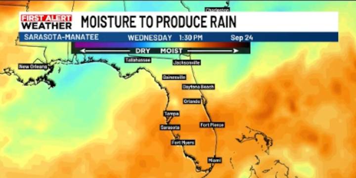
SARASOTA, Fla. (WWSB) -
A similar setup to what occurred yesterday is expected today. Showers and storms will build off the coast, and a few of these may drift inland as the sea breeze builds and moves through by late afternoon into the evening.
Additional showers and thunderstorms could pop up inland, and some of these storms may produce heavy downpours, which could cause brief ponding water making driving difficult during evening rush hours.
In between now and the weekend we may see a minor reduction in our rain chances as some drier air is temporarily forced in by an approaching front.
As the weekend approaches, a front will move closer to the region, boosting rain chances across a wider area. However, this front will not bring much relief from the heat. Highs will remain near the l

 Breitbart News
 FOX 13 Tampa Bay Crime
 Law & Crime
 First Coast Crime
 WCJB-TV20
 Atlanta Black Star