
 KPAX
KPAX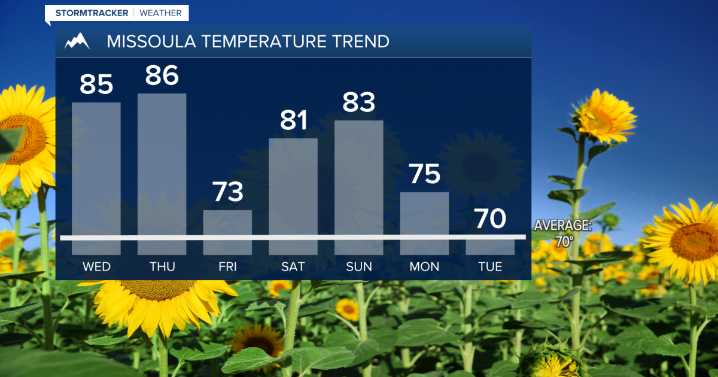
MISSOULA — Our weather trend of chilly mornings followed by warm afternoons continues right on through the weekend.
The warmest days are expected today and tomorrow with highs ranging in the low to upper 80s.
A weak and generally dry cold front is expected to move through Thursday night into Friday of this week. The biggest change with this is highs in the 70s Friday before warming right back into the 80s for the weekend.
Models are showing this ridge breaking down starting Monday of next week.
Highs are looking to drop into the low and mid 70s Monday then upper 60s to low 70s Tuesday. Scattered showers will also make a return to the forecast during this time as well.

 WAFB
WAFB KXLH
KXLH KTVH
KTVH AlterNet